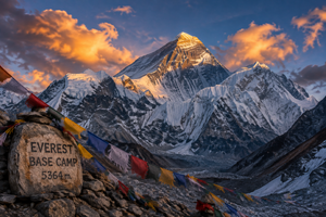
Vinson Massif rises to 4,892 metres above sea level in the Ellsworth Mountains, within the Sentinel Range. It is the highest point in Antarctica and one of the Seven Summits - the highest mountains on each of the seven continents. Its elevation is lower than that of many famous Himalayan giants, but its remoteness, freezing temperatures, wind and demanding logistics make an expedition here a serious polar climb.

Geography of Vinson Massif
The massif lies in the interior of West Antarctica, approximately 1,200 kilometres from the South Pole. It belongs to the Sentinel Range, a high mountain region within the Ellsworth Mountains. Vinson’s summit rises above Branscomb Glacier, which provides the approach for the standard climbing route.
Vinson is not a sharp, isolated rock spire but a vast high-altitude massif with long snow slopes, glaciers, ridges and a summit pyramid. Its scale and changeable visibility make distances difficult to judge, while crevasses in the glacier can be hidden beneath the snow.

The first ascent and the expedition that climbed six peaks
The first expedition to the massif was led by American mountaineer Nicholas Clinch. In December 1966, a team of ten reached the main summit: the first ascents took place on 18, 19 and 20 December, as different expedition parties climbed to the top. This was more than the first ascent of Antarctica’s highest mountain. During the same expedition, the climbers also made the first ascents of five other significant peaks in the region.
On 21, 22 and 24 December 1966, the team made the first ascents of Mount Shinn. On 31 December 1966, and again on 2 and 7 January 1967, expedition members made the first ascents of Mount Gardner. On 6 January 1967, John Evans and Barry Corbet reached the summit of Mount Tyree, which later became known as Antarctica’s second-highest mountain. On 12 January, separate parties made the first ascents of Long Gables and Mount Ostenso.
In 26 days, the climbers opened six peaks to mountaineering. Mount Tyree was the most challenging undertaking: the route crossed Mount Gardner, descended to the col between the peaks, and followed Tyree’s northwest ridge, with difficult rock terrain and a steep summit pyramid. The expedition and its first ascents are documented in the American Alpine Club report on the American Antarctic Mountaineering Expedition.
Routes to the summit
The standard route via Branscomb Glacier. Most commercial expeditions use this route. Climbers move from base camp through lower and upper camps before reaching the summit pyramid. It is primarily a snow-and-ice route, but it is not a simple trek: climbers need to know how to travel roped together and use ropes, crampons and ice axes, as well as be prepared for prolonged exposure to cold and altitude.
The south face and west ridge. On 5 January 1997, Slovenian climbers Viki Groselj, Stane Klemenc and Rafko Vodisek, together with Croatian climber Stipe Božić, reached the summit by a new route up the south face and then onto the west ridge. The climb to the edge of the face took 12 hours, while the entire journey from base camp to the summit took 19 hours. The report describes a snow route with slopes of approximately 45–55 degrees and around 2,500 metres of elevation gain.
Heavenly Father and the west face. In 1993, Joe Bentley and Jay Smith climbed the Heavenly Father route on the west face. In 1995, Spanish climbers ascended a new line to a rocky shoulder that became known as Asturias Peak. In 1997, the Slovenian team linked sections on the west face with an exit onto the west ridge and the summit.
The west ridge. In 1999, Conrad Anker made the first solo ascent of the entire west ridge in a single push. The route involved around 2,000 metres of elevation gain, rock climbing up to 5.6 on the American grading scale, and alpine snow. It is a substantially more technical undertaking than the standard route.
Purple Haze Couloir. On 15 January 2005, American guides Dave Morton and Todd Passey, who usually worked on the standard route, set out for the west face. They crossed a bergschrund and a 40–50-degree snow slope, then climbed a couloir that reached approximately 70 degrees. Above it were a short chimney-like section and around 500 metres of mixed snow, ice and rock climbing on 50–60-degree terrain. They reached the face’s ridge at about 4,600 metres but did not continue the final several hundred metres to the main summit. The route was named Purple Haze Couloir; it is approximately 1,750 metres long and graded up to IV, 70 degrees.
Chilena-Slovak Route and Tack-Tack. In December 2007, Chilean climber María Paz Ibarra, known as Pachi, and Jarmila Tyrril established the Chilena-Slovak Route on the northern part of the west face. It covers roughly 1,200 metres of steep snow, rock and mixed terrain. On 28 January 2008, French climbers Sébastien Bohin and Marion Poitevin opened a nearby new route, Tack-Tack, across steep snow and moderately difficult mixed terrain. The history of these lines is described in an American Alpine Journal overview of routes on the west face.

Climate, altitude and hazards
Antarctic summer does not mean warm weather. Temperatures on Vinson can fall below −30°C, and wind makes conditions feel even colder. On exposed ridges and near the summit, visibility can deteriorate quickly, while strong winds can cancel a summit attempt or delay the return.
The main risks include frostbite, hypothermia, altitude sickness, hidden glacier crevasses and weather delays. Because the massif is so remote, evacuation may not be possible immediately: aircraft cannot land safely in every condition. Buffer days, suitable equipment and group discipline are therefore essential parts of the expedition plan, not optional precautions.
When is the climbing season, and how much does it cost?
The main climbing season falls during the Antarctic summer, roughly from November through January. Polar aviation operates during this period, transporting teams into the interior of the continent. However, the calendar alone does not guarantee good conditions: flights and summit attempts may be postponed because of wind and cloud.
Costs depend on the operator, programme length and logistics. For example, Antarctic Logistics & Expeditions offers a 12-day climbing programme for US$57,900 per person. The overall budget should also account for international flights to Chile, insurance, personal equipment and possible extra expenses caused by weather delays. The included services should be checked in the description of the specific programme.
Ski and snowboard descents
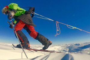
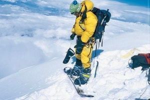
Ski descents from Vinson are documented in mountaineering reports. On 5 January 1997, Viki Groselj skied from the summit down the west face to Camp 3, then returned to base camp by the standard route. The report records an elevation drop of about 2,900 metres, with sections of the slope reaching 45–50 degrees. This was not a routine part of a commercial climb, but a distinct alpine-ski line on a remote face.
Another example comes from the 2007–2008 season, when Norwegian skiers Ine-Lill Gabrielsen and Rita Glenne set out from Vinson on skis toward the South Pole using a new unsupported route. This was not a descent directly from the summit, but a separate long-distance ski journey across Antarctica, often mentioned among the region’s notable ski achievements.
A ski descent from the summit should be distinguished from descents of neighbouring peaks and ski journeys to the South Pole. These are different kinds of achievement, ranging from technical skiing on steep slopes to multi-day polar travel.
Details of Groselj’s descent and his team’s route appear in the American Alpine Journal report on the new route on Vinson.
How many people reach the summit each season?
The number of successful ascents varies with weather, logistics and expedition size. American Alpine Journal season reports recorded 157 people on the summit in 2007–2008; 183 individual climbers reached it in 2010–2011, and 147 in 2011–2012. In 2014–2015, 187 of the 207 people who attempted the climb reached the summit.
These examples provide a realistic reference point: in many seasons, roughly 100–200 people reach the summit. This is not a guaranteed annual figure or an average calculated across all years, but a range reflected in specific published seasonal reports.
Vinson today: from pioneering climbers to modern expeditions
Since Clinch’s first expedition reached the summit, Vinson has become a well-known objective for climbers pursuing the Seven Summits. Yet Antarctica’s remoteness means it cannot be treated like an ordinary commercial trek: even the standard route requires experience with mountaineering equipment, readiness for severe cold and enough time in reserve for bad weather.
Vinson’s story is about more than the continent’s highest point. It includes the first ascents of peaks in the Sentinel Range, the development of technical routes on the west face, and the growth of polar logistics that now allows expeditions to reach one of the world’s most remote mountaineering areas.
For those who feel a connection with mountaineering, Travel Jewelry offers a pendant shaped like an ice axe and a mountain - a symbol of the mountains, climbing and the journey toward a summit.
Skiing in Antarctica: From Early Polar Expeditions to Descents from Mountain Summits
Antarctic Research Stations and Life on the Ice: How Polar Teams Live and Work
Antarctica: From the Search for an Unknown Land to Discovering the World Beneath the Ice
The History of Mountaineering: From the First Ascents to Speed Records
Ski Travel: The History of Ski Touring, Ski Expeditions and Winter Journeys
The History of Skis: Evolution, Types, Technology and Skiing in Sport
Gift Ideas for a Skier: Practical and Meaningful Presents for Winter Enthusiasts