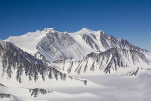
When people talk about mountaineering in Antarctica, they often mention the Vinson Massif - the continent’s highest mountain, where logistics for organized expeditions are well established. But Antarctica is far larger than a handful of famous routes. In East Antarctica, dark rock towers, sharp ridges and isolated nunataks - mountain peaks rising above the glacier - emerge from the ice plateau. Some of these areas are visited mainly by scientists, while others remain rare destinations even for experienced climbers.
Modern expeditions show that the exploration of Antarctic mountains did not end with the era of the great polar explorers. In the 21st century, climbers still establish new routes and make first ascents. This requires not only technical skill, but also meticulous planning, self-sufficiency and the ability to operate far from rapid rescue options.
New Swabia: Mountains Rising from the Ice Plateau
New Swabia is a historical name for a region of East Antarctica associated with the German Antarctic Expedition of 1938-1939. During that expedition, mountains in the region were photographed and mapped from the air. The mountain groups include the Wohlthat Mountains, Humboldt Mountains, Conrad Mountains and Drygalski Mountains. Despite this long history of mapping, much of the region remains rarely visited by mountaineers.

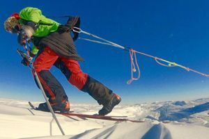
In January 2023, Austrian mountain guide Christoph Höbenreich set out on a three-week expedition to the mountains of New Swabia with a route partner. The aim was to explore parts of the Wohlthat Mountains on skis and on foot, travel through the Humboldt and Petermann mountain ranges, and climb peaks that had not previously been ascended.
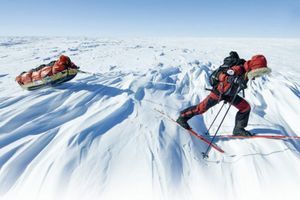
The team covered approximately 100 kilometres on skis and another 50 kilometres during mountain outings. Late in the Antarctic summer, temperatures ranged roughly from -15 to -25°C. Cold was only part of the challenge: the expedition travelled through a remote area where help could not be expected quickly, and route planning had to account for crevasses, wind and snow conditions. Polar Journal’s report on the little-known mountains of New Swabia provides further details about this expedition.
One of the main results was the first ascent of two peaks in the Humboldt Mountains. Höbenreich named them Nanukspitze and Denalispitze. During one of these ascents, he continued alone after his partner decided not to enter a steep couloir about 1,000 metres high. The episode captures a reality of exploratory mountaineering: even within one expedition, team members may make different decisions based on their assessment of risk.
Höbenreich also compared the glaciers he saw with aerial photographs taken during the 1938-1939 expedition. Such observations can be useful for understanding changes in snow and ice cover, but they must be interpreted carefully: glacier appearance depends not only on long-term climate trends, but also on season and weather.
The Gruber Mountains: Seven First Ascents on One Expedition
Another striking example of modern exploratory mountaineering is the expedition to the Gruber Mountains, part of the eastern Wohlthat Mountains in Queen Maud Land. In November 2024, Höbenreich returned with mountain guides Robert Miller and Tom Rabl, as well as physician Katrin Oertel.
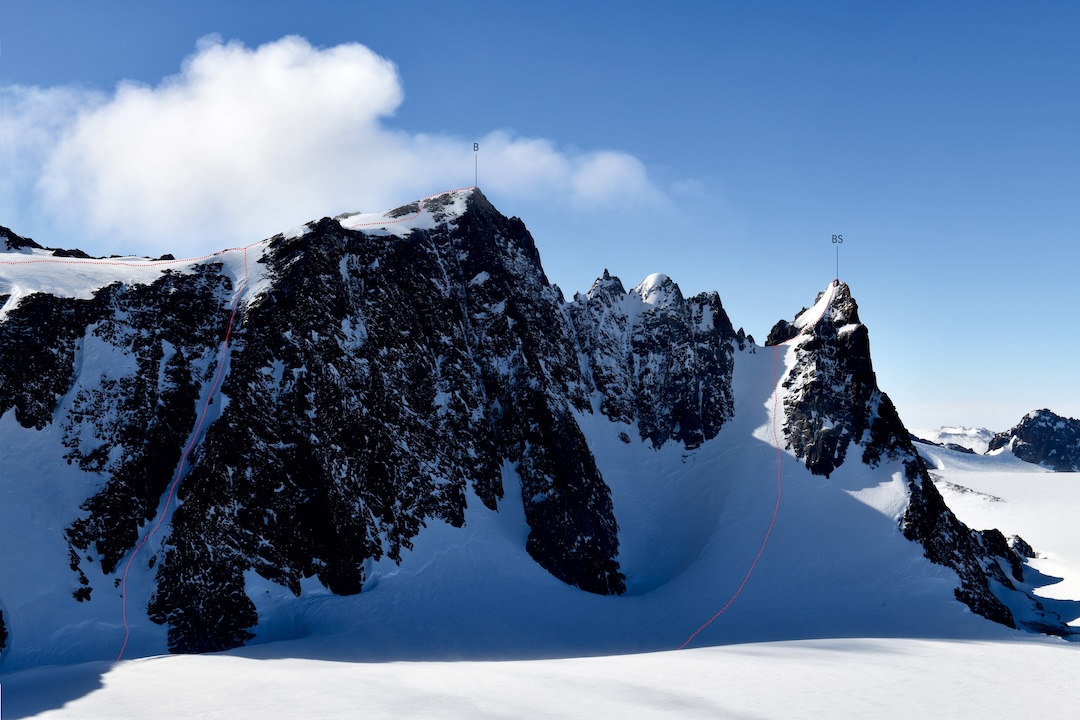
During the expedition, the team climbed nine peaks, seven of which were recorded as first ascents. The climbers not only followed new routes but also proposed names for several peaks that had not previously had documented names. These included Breitwand, Bergführerspitz and Azimutgipfel. Details of the expedition and its routes are documented in Christoph Höbenreich’s report in the American Alpine Journal.
The terrain is far from the image of gentle snow slopes. Some sections involved icy couloirs with slopes of up to 60 degrees, travel across crevassed glaciers and technical rock climbing. On Bergführerspitz, the team reached a narrow rock pinnacle. Such details matter: a mountain’s elevation alone does not determine the difficulty of an ascent, especially in Antarctica, where technical climbing is combined with remoteness and changeable weather.
The history of the Gruber Mountains also shows that geographical names have their own history. Some local features were mapped during the German expedition of 1938-1939. Modern climbers work with this cartographic legacy, refine information and propose names for previously unnamed peaks. However, a proposed name does not automatically become an official geographical name; formal procedures are required.
In his report, Höbenreich expressed concern that plans for conservation status could restrict future private expeditions to this mountain area. This is the author’s concern, not confirmation that access has already been prohibited. The discussion illustrates a difficult balance: Antarctica must be protected, while responsible research and access to remote areas also need to be considered.
Mount Sidley: Antarctica’s Highest Volcano
In Marie Byrd Land, on the other side of the continent, stands Mount Sidley, 4,285 metres high and the highest volcano in Antarctica. It is part of the Executive Committee Range. Unlike the better-known Vinson Massif, Sidley lies in a much less visited region, making logistics a major part of the challenge.
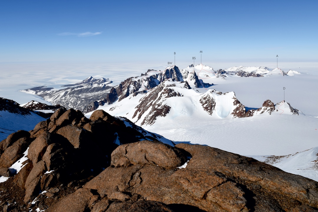
The first ascent of Sidley was made by New Zealander Bill Atkinson on 11 January 1990. He was working as a field assistant with a group of volcanologists studying the area. In January 2011, a team from Antarctic Logistics & Expeditions made the first ascent by a non-governmental expedition. After landing on the ice about 16 kilometres from the summit, the team skied for seven hours to reach camp. The next day, most of the team climbed to the crater rim. The summit outing and traverse along the crater rim took about 13 hours.
At the crater rim, the team initially mistook one point for the highest, then found another that was several metres higher. The detail may seem minor, but it illustrates the realities of remote mountain work: even identifying the highest point can require careful observation, while weather, snow formations and poor visibility can complicate navigation. The history of the first non-governmental expedition is described in the American Alpine Journal report on Mount Sidley.
Sidley is interesting not only as a volcanic summit. Its story shows that an Antarctic expedition begins long before the first step on the slope: people and equipment must be delivered to the right area, a landing site chosen, the approach planned and time allowed for bad weather.
Ulvetanna and Holtanna: Rock Towers of Queen Maud Land
The mountains of Queen Maud Land have a very different character. Dark granite towers rise above the glaciers like fortresses. Among the best-known are Ulvetanna and Holtanna. Their steep walls attract climbers looking for technically demanding routes far from popular mountain regions.
Expedition reports from the late 2000s describe new routes on these peaks, including an ascent of Ulvetanna’s north-west buttress and a new route on Holtanna. Climbing on rock in this environment requires particular attention to temperature, wind and equipment condition. Expedition members reported extremely low temperatures, while the technical routes involved many rope pitches.
These ascents need to be described precisely. A first ascent of a summit, the first ascent of a particular face and the establishment of a new route are different achievements. Even if a mountain has already been climbed, a new line on a difficult wall can be a significant mountaineering accomplishment in its own right. This distinction is especially important in little-known Antarctic regions, where information about older routes may be incomplete.
Why Modern Expeditions Require So Much Preparation
In remote parts of Antarctica, climbers must solve the problems of both mountaineering and polar travel. The hazards go well beyond steep slopes or difficult rock.
- Hidden crevasses. A snow bridge can conceal a deep crevasse, so glacier travel requires constant assessment of the terrain.
- Katabatic winds. Dense, cold air flows down from the high interior plateau toward the coast and can produce powerful gusts and blizzards.
- Cold and frostbite. Low temperatures make manual tasks, equipment handling and staying warm in camp more difficult.
- Remoteness. In rarely visited areas, rescuers cannot be expected to arrive quickly. Evacuation depends on weather, aircraft availability and suitable landing conditions.
- Self-sufficiency. Teams must carry equipment for shelter, food, navigation, repairs and communications, and have a plan for delays.
That is why an expedition begins with logistics and risk assessment. Teams must plan the route, camps, fuel and food supplies, communication methods, and the conditions under which they will abandon an ascent. In Antarctica, knowing when to turn back is just as important as technical skill on the route.
Balancing Exploration, Mountaineering and Conservation
Antarctica is not a place without rules. Expedition activity is governed by national procedures and the international Antarctic Treaty System. Organizing a trip may require permits and an environmental impact assessment; specific requirements depend on the country, organizer and nature of the activity.
A responsible expedition should minimize its footprint: leave no waste, avoid disturbing wildlife, protect scientific sites and follow the rules for protected areas. In a place where every human presence requires substantial resources and logistics, these principles are not a formality but part of expedition culture itself.
At the same time, new ascents help improve descriptions of the geography, terrain and routes of little-known regions. The task of exploratory mountaineering is not simply to add another name to a list of peaks, but to do so with respect for the environment, local history and the people who worked in the region before the current expedition.
Are There Still Unknown Peaks in Antarctica?
The answer depends on what we mean by an unknown peak. Many mountains have already been mapped using aerial photography and satellite data, but that does not mean they have been climbed. In other cases, scientists or members of earlier expeditions may have visited a peak, but a detailed route report was never preserved or widely published.
That is why primary mountaineering reports matter. They help establish who made an ascent, which route the team followed, what difficulties it encountered and what can reasonably be described as a first ascent or first route. The Gruber Mountains expedition shows that even today, an expedition can add several new ascents to the mountaineering record.
Perhaps the most interesting thing about Antarctic mountains is not the idea of an “untouched summit” itself, but the opportunity for exploration. There are still areas where maps, historical photographs, scientific observations and climbers’ experience complement one another. Each expedition leaves not only tracks on a route, but also new knowledge about one of the most remote mountain environments on the planet.
A Symbol of the Mountain Journey
Mountains teach respect for the route, the weather and our own limits. In Antarctica, this feels especially tangible: an ice wall, a narrow rock ridge or a distant summit reminds us that every ascent is built on preparation, decisions and responsibility for the team.
This idea is reflected in the Ice pendant by Travel Jewelry - a silver piece shaped around a mountain peak and an ice axe. It is a symbol for people drawn to mountaineering, cold mountain routes and the feeling of finally reaching a summit after careful preparation.
Solo Expeditions in Antarctica: Journeys to the Limits of Human Endurance
Crossing Antarctica: The Most Challenging Routes Across the Continent
Women in the History of Antarctic Exploration: Pioneers, Scientists and Polar Explorers
Mountaineering in Antarctica: Mountains, Volcanoes and Unclimbed Peaks
Vinson Massif: Climbing Antarctica’s Highest Peak
Peter Habeler: The Climber Who Changed the Meaning of "Without Oxygen"
Piolets d'Or 2026: Winners, Outstanding Ascents and Special Awards
The History of Mountaineering: From the First Ascents to Speed Records
Ski Mountaineering: History, Evolution and the Most Challenging Ski Descents